.jpg)

.jpg)



.svg)
The UK is heading into a cooler and more unsettled spell of weather as meteorological summer comes to an end and schools return.
Following a brief rise in temperatures on Sunday, low-pressure systems are expected to bring more rain and strong winds across the country. Northern parts of the UK are likely to see the worst of the unsettled conditions early in the week, while the weather should become calmer on Wednesday and Thursday.
Temperatures will also drop across much of England and Wales after reaching nearly 29C (84F) in south-east England on Sunday.
Although many areas experienced a largely dry weekend, the previous week was the wettest week recorded in England since early February, according to the Environment Agency.
Meanwhile, Spain experienced much hotter conditions, with temperatures reaching 45.7C in Huelva last week. It was the highest temperature recorded in the country so far this year.
Cooler Weather Arrives
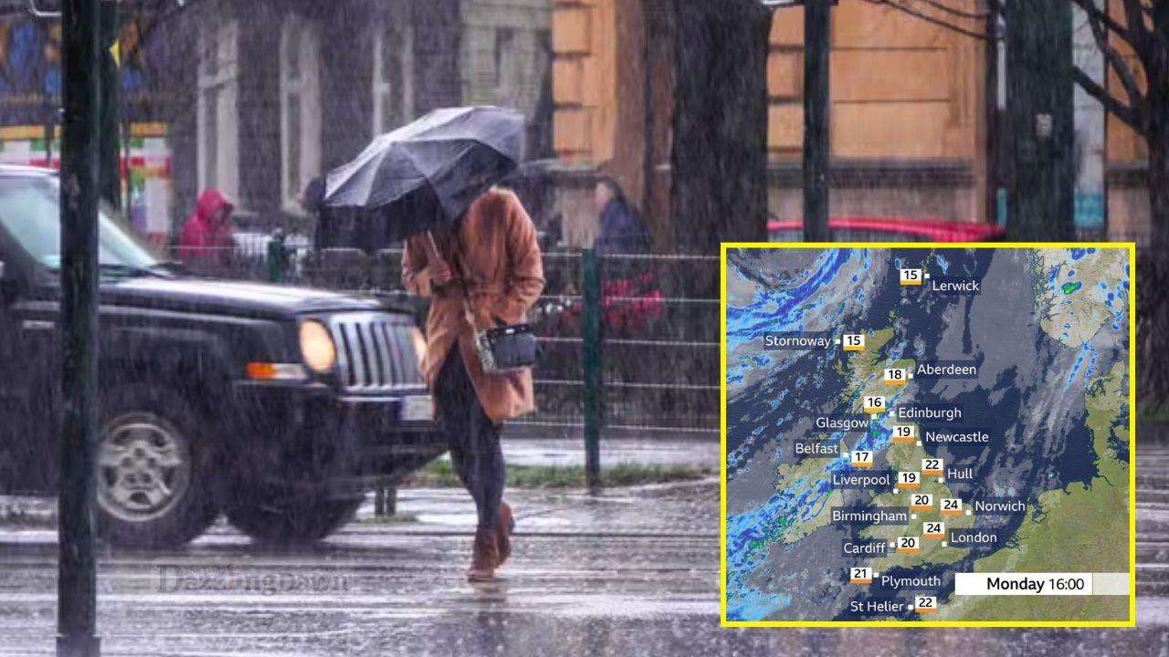
Low pressure will remain positioned to the north-west of Scotland on Monday, pushing a series of weather fronts across the UK. A cold front moving down from the north-west will bring fresher and cooler air to many areas.
As the front moves across England and Wales, it will mainly bring cloud and a few showers before clearer and sunnier conditions develop behind it. Temperatures are expected to reach around 25C in south-east England.
Cooler and less humid air will follow the weather front, making conditions feel noticeably fresher.
A separate area of heavier rain is expected to develop over Northern Ireland on Monday morning before spreading into Scotland and Cumbria during the afternoon.
Strong and gusty south-westerly winds will accompany the rain, with temperatures likely to remain around 17C in Scotland and Northern Ireland.
Strong Winds in Northern UK
The deep area of low pressure will remain to the north-west of Scotland on Tuesday, bringing particularly windy conditions to northern parts of the UK.
Northern and western Scotland could experience wind gusts of between 50 and 60mph. Although strong winds are common in these areas during this time of year, disruption could occur if the winds become concentrated through the central lowlands.
Frequent showers are also expected across the north alongside the strong winds.
Further south, parts of England and Wales will see some rain during Tuesday morning. Rain that develops overnight is expected to linger across south-east England before gradually clearing.
The rain is not expected to be particularly heavy, while much of England and all of Wales remain affected by drought conditions.
Weather to Settle Midweek
The low-pressure system is expected to move into the North Sea on Wednesday, bringing a period of strong winds to eastern coastal areas.
Elsewhere, rising air pressure should bring a more settled spell, with most areas expected to remain dry. Some sunshine and lighter winds are also likely.
Showers are forecast to return to western parts of the UK on Thursday, before gradually moving eastwards and weakening on Friday.
From the middle of the week, temperatures are expected to return closer to the seasonal average. The warmest conditions will be in south-east England, where temperatures could reach around 22C.



.jpg)