


.svg)
Londoners woke up to a wet start on Monday as heavy rain drenched the capital, with forecasters warning that thunderstorms could move in later in the day. Commuters faced a soggy rush hour as they made their way through the rain to work.
The Met Office issued a yellow thunderstorm warning for London, which took effect at 3am and remains in place until 9pm on Monday. Forecasters have predicted that some areas of the UK could experience up to half a month’s worth of rainfall in a single day, with summer storms bringing a risk of flash flooding.
Parts of the UK are bracing for heavy, thundery showers, with an amber rain warning in effect until 8am on Monday for eastern Northern Ireland. According to Met Office forecaster Simon Partridge, Northern Ireland is likely to bear the brunt of the rain, potentially seeing 50 to 75mm within 12 to 18 hours — more than half of the region’s typical July rainfall of 89mm falling in less than a day.
There is a particular risk of flash flooding in County Antrim, Armagh, and Down as intense showers batter the area overnight and into Monday morning. Meanwhile, parts of England and Scotland could receive 20-40mm of rain in just two hours during the day.
From 3am to 9pm Monday, a yellow thunderstorm warning covers southern and eastern England, expanding to include the Midlands, northern England, and Scotland by 11am. Over 20 flood alerts remain active across England and Scotland. Where flooding or lightning occurs, the Met Office warns of possible delays or cancellations to trains and buses, along with the chance of power outages and dangerous floodwaters.
Mr. Partridge added that locally heavy downpours could bring as much as half a month’s rainfall in just a couple of hours in some areas, creating hazardous driving conditions with waterlogged roads. While river flooding is unlikely due to currently low water levels, localized flooding and disruption are possible.
The unsettled weather is being driven by low pressure and warm, humid air, which is fueling heavy showers and thunderstorms. However, even within the warning areas, some places may remain dry. Gusty winds, lightning, hail, and localized flooding are possible where storms do develop.
The forecast for the rest of the week remains changeable, with showers expected on Tuesday and potential thundery downpours in the southeast on Wednesday. Temperatures are expected to stay around the seasonal average.
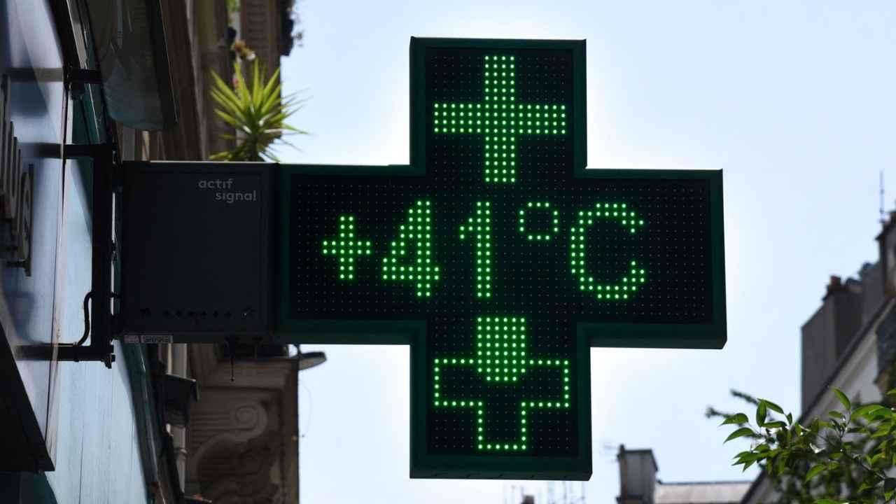
This spell of wet weather follows a hot and dry spring, with three heatwaves already recorded this summer. The Environment Agency has noted that England experienced its driest March-to-June period since 1893, leaving parts of the country in drought. The parched ground may worsen flooding risks, as dry soil is less able to absorb heavy rainfall.